Welcome back for Part 2 in our 3-part blog series about hail storms. Make sure to check out part 1 If you missed it! Part 1 – “So, What Causes Hail Storms?”. In this part, we will examine how the meteorological conditions discussed in Part 1 contribute to the devastating hail storms produced in two of continental North America’s most battered cities; Calgary, Alberta and Colorado Springs, Colorado.
Calgary and Colorado Springs Hail
Calgary and Colorado Springs are both infamous for their severe hailstorms; storm systems that brutalize backyard gardens and entire crops with a total lack of impunity. They backlog auto body repair shops for months and strike fear in the hearts of dealership owners. So much so, that this north-south band of the continent has been nicknamed ‘Hailstorm Alley’. Despite being hundreds of miles apart geographically, it’s no mere coincidence that both of these cities are frequent targets of mother nature’s ire. In fact, these cities share several key similarities that shed some light on their proclivity for severe hail events:
- Surrounded to the west by flat open plains
- Located downwind of the Rock Mountains mountain range (i.e., large elevation changes between mountains and plains); and
- Moderate continental climate, with cold winters and abundant sunshine through the spring and summer.
During the spring months, temperatures begin to rise and cause snowpacks in the mountains to melt. As this happens, streams and rivers swell, as well as the lakes that they feed into. With the spring sun warming these water bodies and the surrounding plains, two things occur: (1) the air temperature rises, causing humidity to rise (i.e., the amount of water vapour the air can hold), and (2) the rate of water evaporation increases, causing the relative humidity to rise (i.e., the amount of water vapour in the air as a percentage of the maximum amount it can hold).
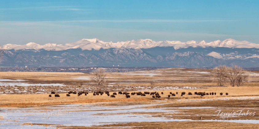
Photo by Tony Takes
This process is aided by the fact that the plains at the base of the Rocky Mountains act like giant solar panels – the large, mostly flat surfaces are very effective at absorbing the sun’s heat and transferring it to the air parcels at the ground surface. Meanwhile, westerly winds originating on the Pacific Coast are pushed up and over the Rocky Mountains, creating regions of high pressure over the peaks, and low pressure in the valleys. The high pressure above the peaks effectively squeezes any moisture out of the air, dumping it onto the peaks and valleys across the mountain range. For this reason, most of the ski resorts on the west side of the Rocky Mountains enjoy greater average snow accumulation, but milder temperatures. Conversely, resorts on the east side receive less average snowfall but colder average temperatures.
The end result is a cold, high-pressure front exiting the east side of the Rockies, towards our fateful case study cities. As the cold front from the mountains collides with the warmer low-pressure system above the plains, it displaces these moist air parcels and pushes them upwards into the atmosphere. This is how a lifting force, also know as an updraft, is formed.
As the updraft pushes warm, humid air parcels upwards, they continue to collide with the prevailing westerly winds carrying colder air from over the Rockies. The warm air naturally wants to rise above the cold, so the updraft force is accelerated. This is a classic example of an unstable air mass; the differential heating of these air parcels causes the warm humid air to rise faster and faster yet. Eventually, the humid parcels will begin to cool, and then saturate and condense, creating cloud mass. At this point, we have satisfied the 3 criteria needed for the formation of cumulonimbus clouds: moisture, lifting force, and atmospheric instability.

The Perfect Hail Storm
For both of our case study cities, we have seen how their common physical and climatic characteristics contribute to the formation of the cloud cells known to cause hail storms. But hail requires a final, fourth criterion in that the freezing level elevation must be low enough that hail forming in the clouds remains frozen until it reaches the ground. This criterion cannot be overlooked – for instance, many coastal cities in Florida have all the criteria for cumulonimbus clouds to form, but the low-altitude and warm climate mean the freezing level elevation is (generally) too high for hail storms to occur. Conversely; Calgary, with its northern latitude, and Colorado Springs, situated over a mile above sea level, check off that fourth and deciding criterion, lifting these cities into the upper echelon – nay, atmosphere of biggest hail producers.
Cold, Hard, Icy Facts about Hail
- 3 June 1959; hail accumulation up to 45 cm deep blanketed Seldon, Kansas during this hailstorm intense, concentrated hailstorm.
- 14 April 1986; the heaviest hailstone ever recorded, 1.02 kg (2.25 lb), fell during this storm in Golpalganj district, Bangladesh, which produced hailstones the size of grapefruits.
- 23 July 2010; the largest hailstone ever recorded fell in Vivian, South Dakota; measuring 20.3 cm (8.0 inches) in diameter.
Written by Taylor Gallivan